
Clickable NWS National Advisory Maps
Maps autoupdate every few minutes.

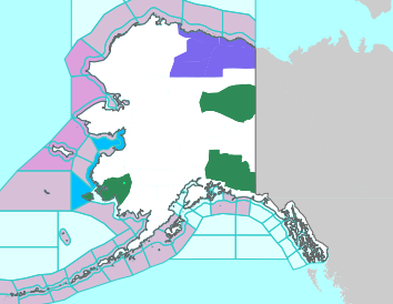
Click on map to open a new tab zoomed to the area of interest where the local legend decodes the colors and links to detailed text alerts.
The NWS map which opens is in turn clickable to then display VERY localized conditions and a 7 day forecast.
All Maps and Data Are Courtesy of NOAA/NWS where any missing legend links can be found.
Here is a complete NOAA/NWS alerts legend color code listing.
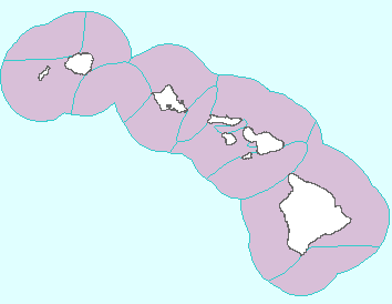
The NWS map which opens is in turn clickable to then display VERY localized conditions and a 7 day forecast.
All Maps and Data Are Courtesy of NOAA/NWS where any missing legend links can be found.
Here is a complete NOAA/NWS alerts legend color code listing.