|
 58.3°F
Cool
Wind Chill:
58.3°F
|
| Temp |
Highs |
Lows |
| Today: |
58.8°F
11:18am |
30.9°F
6:04am |
| Yesterday: |
59.5°F
4:14pm |
33.1°F
6:16am |
| One Year Ago: |
58.7°F |
31.2°F |
| Station RecordOn This Date:4 |
66.4°F
2018 |
30.4°F
2015 |
| This Month: |
73.8°F
Apr 9 |
29.3°F
Apr 8 |
| Windsor LocksRecordOn This Date:5 |
88°F
2009 |
26°F
1919 |
| Normal:5
|
65 °F |
42 °F |

|
It is Day time
|

|
Wind:
NW
0.6
Gusting to:
0.0
|
 |
Rain:
0.00 in
|
Outside Temperature |
|
Last Hour:
|
+7.4°F
|
|
24 Hour:
|
+8.3°F
|
Outside Averages |
| MTD Average: |
47.4°F |
| YTD Average: |
37.8°F |
Inside Temperature |
| Currently: |
 70.6°F 70.6°F
|
| Last Hour: |
0.0°F
|
|
Today

Sunny
|
Tonight

Mostly Clear
|
Saturday

Mostly Sunny
|
|
Hi 58 °F |
Lo 33 °F |
Hi 60 °F |
Click here for Local 5-day Forecast
|
| Season Dates: |
|
Summer begins in |
55
days |
June 20th @ 4:52pm
We've already gained
4 hours and 47 minutes of daylight! |
| Upcoming Holidays |
|
Memorial Day |
May 27th |
| Dew Point |
Rain
|
Wind |
Sun/Moon |
| Dew Point: |
31.5°F
|
|
Really Dry
|
| In Last Hour: |
+4.1°F |
High Dew
Point: |
34.9°F
at 8:50 AM |
Low Dew
Point: |
25.5°F
at 10:39 AM |
Record Dew
Point: |
84.0°F
Jul 20, 2013
|
| Wetbulb: |
47.0°F
|
| Humidity |
| Humidity: |
 36 %
36 %
|
| In Last Hour: |
-4% |
High
Today |
94%
at 6:10 AM |
Low
Today |
32%
at 11:10 AM |
| Barometer |
| Current: |
30.640 inHg
|
| In Last Hour: |
Steady
|
| In Last 3 Hours: |
Steady |
|

|
Rain Today:
|
0.00 in
|
|
Rain Last Hour:
|
0.00 in
|
|
Rain Yesterday:
|
0.00 in
|
| Last 7 Days: |
0.14 in
|
|
April Rain:
|
4.23 in
|
Apr to Date
Avg:10
|
3.63 in
|
Apr to Date
Diff from Avg:10
|
0.60 in
|
April Avg
for Whole Month: |
4.35 in
|
| YTD Rain:1 |
24.38 in
|
| YTD Avg11
|
13.37 in
|
YTD
Diff from Avg:11
|
11.01 in
|
| Last YTD Rain:1 |
12.46 in
|
|
Last Rain:
|
Apr 20
at 6:15 AM |
| Storm Total: |
0.14 in |
|
10 Days in April |
|
45 Rain/Snow Days in 2024 |
|
5 Days since last rain
|
|
| Currently: |
NW at
0.6 mph
|
|
Calm
|
| Gusting To: |
0.0
|
Max Gust
Last Hour: |
7.5 mph NNE
at
10:57 am
|
Max Gust
Today: |
8.1 mph
at
10:57 AM
|
| Wind Run: |
1.96 miles
|
Max Gust
This Month: |
20.7 mph
on
Apr 6 |
Max Gust
This Year: |
26.9 mph
on
Jan 14 |
Max Gust
Record |
40.3 mph
Oct 26, 2014 |
|
Wind Chill |
| Current: |
58.3°F
|
| Today: |
30.9°F
at 6:04 AM
|
| Yesterday: |
33.1°F |
| Record: |
-24.0°F
Feb 14, 2016 |
|
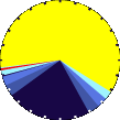
13 hours,
51 minutes
of Daylight
- - - - - - - -
(Noon)
 (Midnight)
- - - - - - - -
Which is
2 min 30 sec
Longer Than
Yesterday
|
|
Waning Gibbous Moon |

|
92%
Illuminated |
|
|
|
|
|
| Allergy |
Snow3 |
Lunar Summary |
Cloud Level |
Predominant Pollen:
Maple, Birch, and Oak
--------------------------- |
| Friday |
Saturday |
| April 26, 2024 |
April 27, 2024 |
|
10.1
|
10.2
|
|
| Snow Today: |
0.00 in
|
| Yesterday: |
0.00 in
|
| April Snow: |
0.25 in
|
| April Avg: |
1.30 in
|
| Diff from Avg: |
-1.05 in
|
| Season Total:2 |
29.35 in
|
| Season Average:2 |
40.83 in
|
| Diff from Avg: |
-11.48 in
|
| Last Snow: |
Apr 4 |
| Storm Total: |
Dusting |
|
Current
Snow Depth: |
0.00 in
|
|
1 Snow Day in April |
|
16 Snow Days this Season.2
|
First Snow of this Season:
December 6th
|
Average First Snow:
November 28th |
|
| Moonrise: |
10:02 pm |
| Moonset: |
7:04 am |
|
Full Flower Moon: |
|
May 23 |
| New Moon: |
May 7
|
| Next Lunar Eclipse: |
|
Sep 17, 2024
|
|
See Astronomy Page |
|
See Moon Names Page |
| Solar Summary |
| Sunrise: |
5:56 am |
| Solar Noon: |
12:51 |
| Sunset: |
7:47 pm |
| Next Solar Eclipse: |
|
Apr 8, 2024
|
|
See Astronomy Page |
| Heating Degree Days2 |
| Today: |
13.3 |
| April: |
449.3 |
|
Season
to Date: |
5208.0 |
|
Cooling Degree Days |
|
2024 to Date: |
0.0 |
|
See Degree Day Info Page
|
|
|
|
|
|
1 Rain season: Jan 1st to Dec 31st.
2 Snow & heating degree day season July 1st to June 30th.
3 Snow manually measured, usually around 6PM.
4 Station high/low records for this date, exclusive of todays readings, since 2013.
5 Windsor Locks Record and Normal temperatures are at Bradley International Airport, Windsor Locks, CT and are updated at 4AM.
6 Overnight Frost calculation starts at 10AM and resets to zero at 10AM the next day.
10 Historical average only to day 26 of just the month of April for this station since 2012
11 Historical average rain this year to day 26 of April for this station since 2012 |
| NWS Weather Forecast -
Outlook Today & Tonight |
Today
Sunny
Hi 58 °F
|
NWS forecast: Sunny, with a high near 58. South wind around 5 mph.
|
Tonight
Mostly Clear
Lo 33 °F |
NWS forecast: Mostly clear, with a low around 33. South wind 2 to 6 mph. |
|
| NWS Short Term Weather Forecast |
|
Saturday
Mostly Sunny
Hi 60 °F |
Saturday
Night

Chance Rain Showers
Lo 42 °F |
Sunday

Chance Rain Showers then Partly Sunny
Hi 69 °F |
Sunday
Night

Partly Cloudy
Lo 54 °F |
Monday

Partly Sunny
Hi 76 °F |
Monday
Night

Mostly Cloudy
Lo 54 °F |
Tuesday
Mostly Cloudy then Chance Showers And T-Storms
Hi 67 °F |
|
| Click here for Local 5-day Forecast
|
|